


Elizabeth Brook Watershed Resiliency Program
How Newport is addressing flooding in Hillside, Bedlow, Malbone, Prescott Hall, and the North End
Recurring flooding affects residents, property, travel, and public safety. Newport is advancing coordinated infrastructure, environmental, and resilience work across the connected Elizabeth Brook watershed.
Updated August 11, 2026
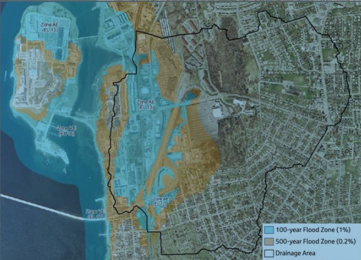
Bottom line
One connected watershed requires coordinated projects
The City is taking action, but there is no single maintenance activity or isolated pipe project that can address flooding throughout this connected watershed. Newport is advancing Phase 1A design and evaluating a coordinated watershed program that may include conveyance, detention, channel, culvert, floodplain, water-quality, habitat, and public-space projects. Potential future projects are not commitments until they are separately modeled, designed, permitted, funded, procured, and authorized. Every project must demonstrate that it will not materially increase flood risk or create unacceptable impacts elsewhere.
Current status
Completed, underway, and future work
Status is presented in three categories: completed work, work in design or review, and potential future projects that have not been authorized.
Completed
- Historical drainage investigations.
- Immediate operational actions identified in the 2013 Malbone study.
- Drain rehabilitation and related RIDOT drainage work.
- Updated survey, environmental review, flow monitoring, and hydraulic model development.
Underway
- Phase 1A conveyance design and approvals.
- Federal EDA grant application submitted; award pending.
- Section 106 consultation package submitted August 5, 2026; RIHPHC review pending.
- Phase 1B detention and flow management planning and evaluation; construction not authorized.
- Ongoing City drainage inspection and maintenance.
- Monitoring, model refinement, permitting, property, and agency coordination.
Future Work
- Hillside, Bedlow, Smith, and Malbone drainage improvements.
- Malbone Channel improvements.
- Downstream channel and culvert projects.
- Additional storage.
- Elizabeth Brook daylighting and floodplain restoration.
- Water quality, habitat, and public space improvements.
| Control item | Status |
|---|---|
| Phase 1A scope | Prescott Hall conveyance improvements, including the Route 138 trenchless crossing. |
| Design status | In design. 95 percent design package with a June 15, 2026 draft Preliminary Engineering Report. |
| Construction estimate | Approximately $9.24 million for Phase 1A construction, based on the 95 percent design package. Estimates are refined as design advances. |
| Cost basis | The construction estimate does not yet present total project cost. Engineering, construction administration, contingency, escalation, property rights, environmental and soil management, and grant-noneligible components are being confirmed and will be published with the final project budget. |
| Federal EDA assistance | Approximately $4.39 million requested under EDA Application No. 00008547. Award decision pending. |
| City funding | Proposed City share of the current construction estimate: approximately $4.85 million, subject to final project cost development and City appropriation. |
| Section 106 historic review | Package submitted to RIHPHC August 5, 2026 with receipt confirmed; RIHPHC indicated it will provide comments within 30 days. Public written comments requested through September 4, 2026. Concurrence pending. |
| Other permits | Applications to RIDOT, RIDEM, and other agencies will follow as design advances. |
| Property rights | Property coordination ongoing. |
| Procurement | Procurement and construction packaging in development. |
| Construction | No start date is published. Phase 1A will not be recommended for construction authorization until the current hydraulic and design review confirms acceptable standalone performance under the applicable design conditions, confirms that Phase 1A does not rely on Phase 1B to avoid unacceptable downstream impacts, and design, approvals, funding, property rights, and procurement are complete. |
| Next decisions | RIHPHC Section 106 concurrence and the federal EDA award decision. |
| Next status review | Quarterly or upon a material change, whichever occurs first. |
Connected system
How the watershed works
The Elizabeth Brook watershed covers approximately 600 acres in Newport and a small part of Middletown. The exact calculated area varies slightly by study purpose and delineation method.
Hillside Avenue, Bedlow Avenue, Smith Avenue, and Malbone Road are within the upper Malbone drainage area. Other North End drainage areas also contribute flow to the lower system.
Runoff from Hillside, Bedlow, Smith, and Malbone enters local catch basins and storm drains and is conveyed to the cobblestone-lined Malbone Channel.
Runoff from Garfield, Evarts, Prescott Hall Road, Southmayd, Butler, and surrounding streets enters a separate neighborhood drainage network, where Phase 1A conveyance improvements are in design and Phase 1B flow management remains under evaluation.
The branches connect to the lower drainage system, which includes channels, culverts, and State drainage facilities, and discharges to Coasters Harbor. Harbor water levels can influence how freely the system drains.
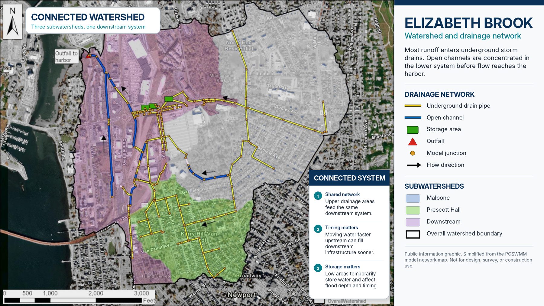
Drainage responsibility is shared. The City owns and maintains neighborhood drainage assets and the Malbone cobblestone stormwater channel. RIDOT owns or maintains drainage facilities associated with the State highway corridors, including downstream swales, channels, and culverts. Private drainage assets also connect to the public system. Ownership and maintenance responsibility must be confirmed for each asset and each proposed project.
Historical context
The watershed before modern development
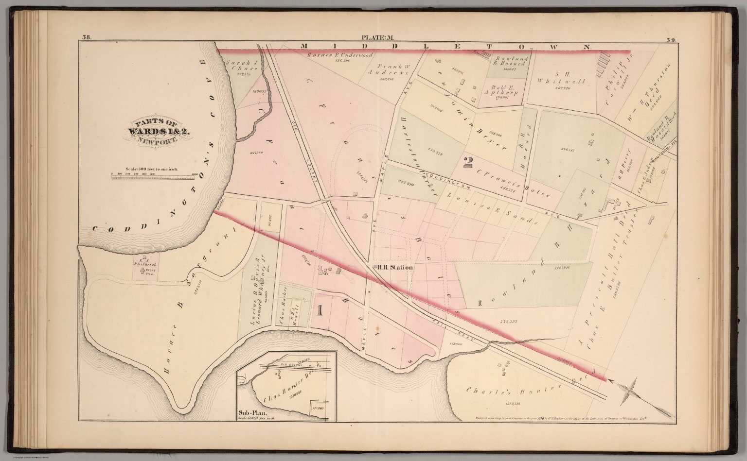
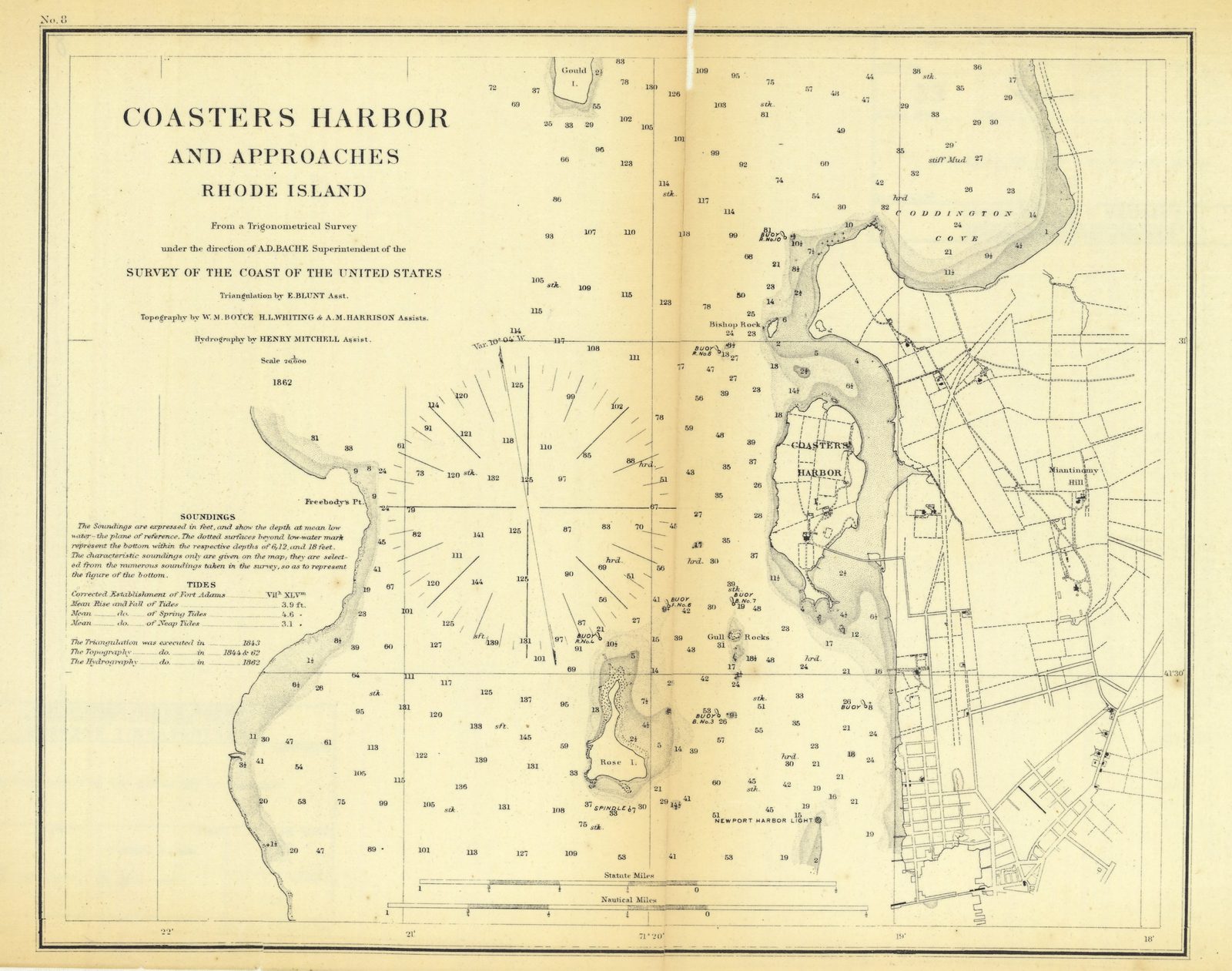
Historical maps and charts record the shoreline, watercourses, wet areas, and land use of the North End before modern streets, storm drains, and development. They are part of the public record the City uses to understand how the watershed has changed and why water still collects in certain areas today.
Multiple causes
Why flooding occurs
Flooding results from several conditions acting together. The importance of each factor varies by storm and location, and the cause during one storm may not be identical to the cause during another storm.
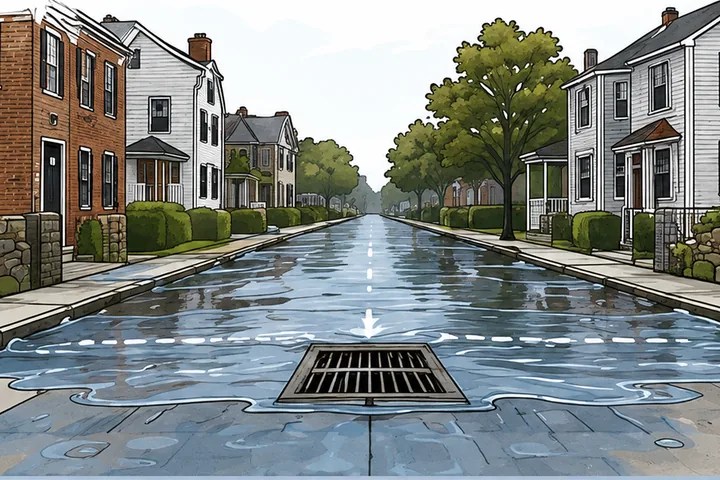
Low-lying areas
Water collects in neighborhood and roadway low points before it can enter or move through the downstream system.
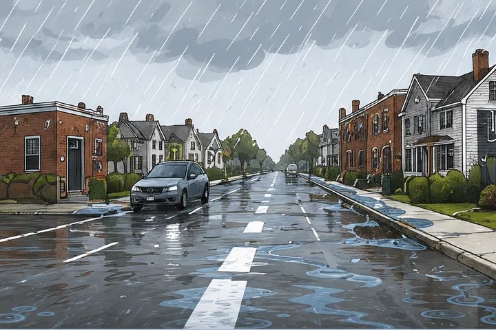
Intense rainfall and developed surfaces
Roads, roofs, parking areas, and other hard surfaces create rapid runoff during high-intensity storms.
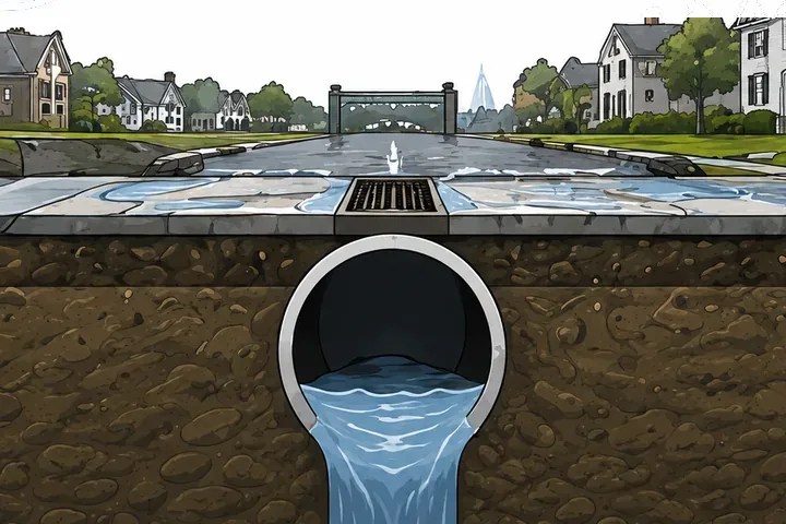
Limited pipe and culvert capacity
Many parts of the drainage system were built decades ago. Some pipes and culverts cannot carry the full flow produced by larger storms.
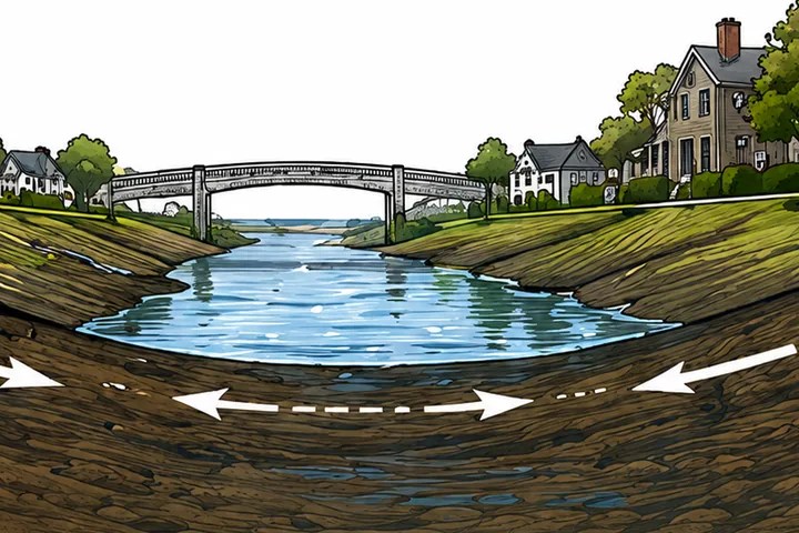
Flat or adverse channel grades
Technical investigations identified flat and locally adverse grades in lower reaches, and a downstream culvert invert that sits higher than the upstream channel bed further restricts drainage. Water drains slowly and can remain backed up.
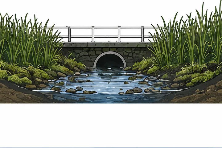
Sediment and vegetation
Sediment and dense vegetation can reduce usable channel area and increase maintenance needs. They are one factor, not the only cause.
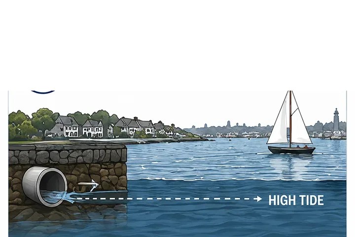
Tidal influence and backwater
Water levels near the harbor can reduce available downstream drainage head. Backwater can slow discharge without causing reverse flow.
Flow monitoring in 2024 and 2025 did not record negative flow at the monitored locations during the periods captured. The data did identify tidal influence and backwater effects.
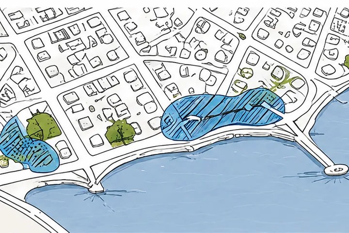
Limited outlets and flood storage
Existing low areas and floodplain areas temporarily store water. Removing or bypassing that storage can increase peak flow or flood elevations elsewhere.
Illustrations are conceptual. They are not site-specific and not to scale.
Move, hold, release
Why larger pipes alone are not enough
Where justified, larger pipes can relieve a local bottleneck. They can also move more water downstream sooner and fill downstream infrastructure faster. Before construction, the City must evaluate downstream pipes, channels, culverts, storage, outlets, tidal influence, future conditions, utilities, operations, and maintenance.
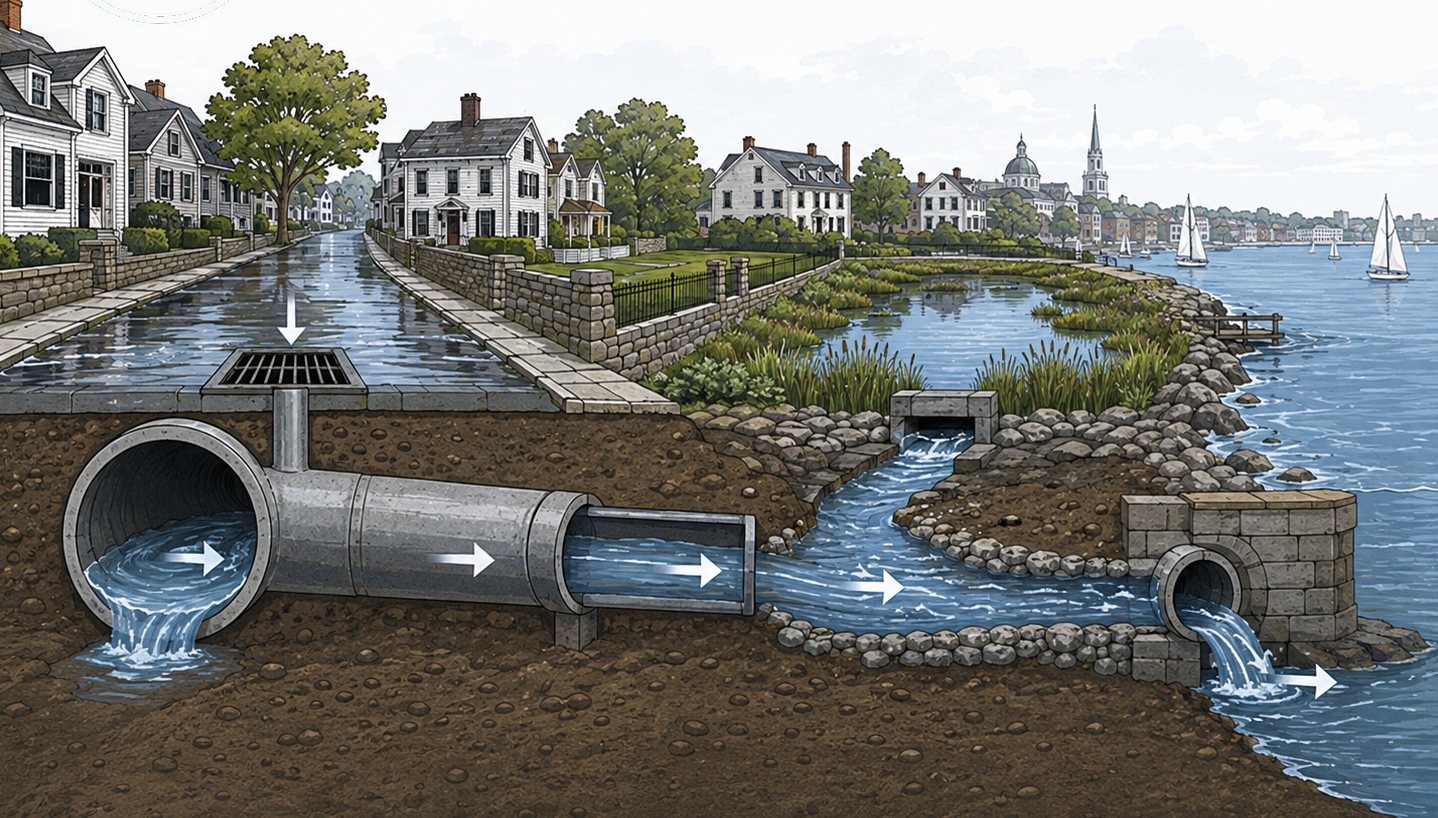
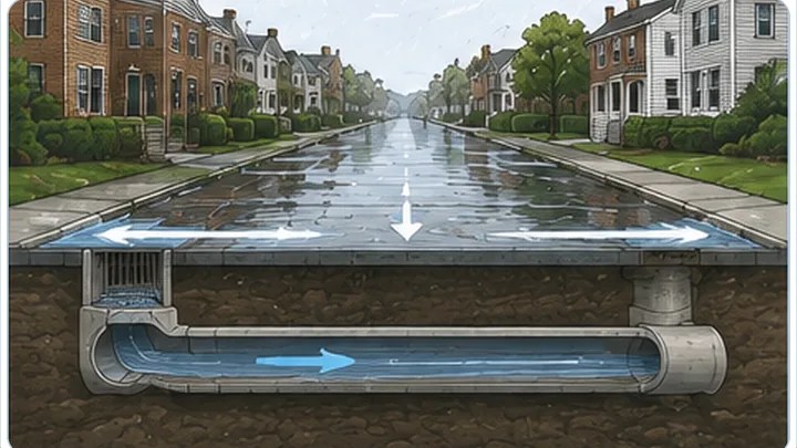
Move safely
Convey water through streets, drains, channels, and culverts without creating new hazards.
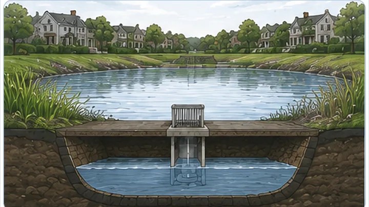
Hold temporarily
Store runoff temporarily in storage and floodplain areas to reduce peak flow.
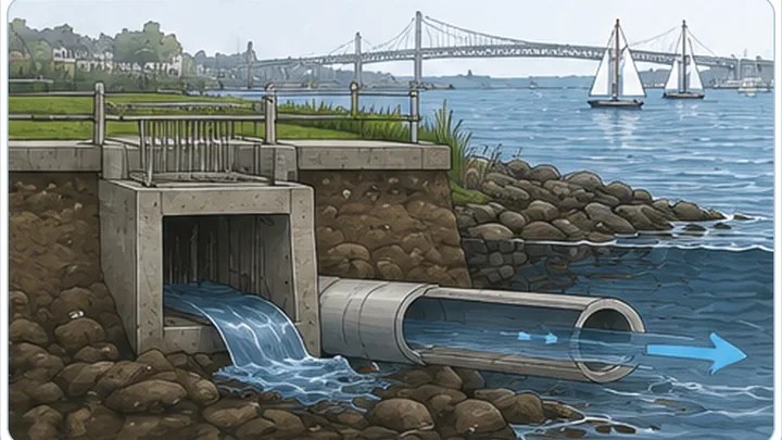
Release gradually
Control the timing and rate of discharge so downstream infrastructure is not overloaded.
Illustrations are conceptual. They are not site-specific and not to scale.
Coordinated capital program
Program components
Conveyance
Detention and Flow Management
Initial conveyance
Phase 1A: Prescott Hall Conveyance Improvements
Phase 1A includes new and larger storm drains on Garfield Street, Evarts Street, Prescott Hall Road, Southmayd Street, Butler Street, and the Route 138 trenchless crossing. The work is intended to improve conveyance through the Prescott Hall area and create an initial connection for the broader program.
Phase 1A remains in design. The design has advanced through a 95 percent design package and the June 15, 2026 draft Preliminary Engineering Report.
The City submitted its Section 106 historic consultation package to the Rhode Island Historical Preservation and Heritage Commission on August 5, 2026, requesting concurrence with a proposed finding of No Adverse Effect. RIHPHC confirmed receipt, added the project to its review queue, and indicated it will provide comments within 30 days. A public notice was issued with the submission. Submission is not the same as agency concurrence. RIHPHC concurrence and final federal action remain pending.
Public comment
Section 106 public comment period, through September 4, 2026. Written comments on the City’s proposed finding of No Adverse Effect for the Phase 1A undertaking are requested through September 4, 2026. Email comments to utilities@NewportRI.gov and reference the Elizabeth Brook Phase 1A Section 106 consultation, EDA Application No. 00008547. The public notice and consultation package are available from the Department of Utilities on request. All comments received will be provided to RIHPHC and EDA for the consultation record. Submission of the City’s package does not constitute RIHPHC concurrence.
The City has submitted a federal grant application to the U.S. Economic Development Administration, EDA Application No. 00008547. An award decision is pending.
Peak flow management
Phase 1B: Prescott Hall Detention and Flow Management
Phase 1B is intended to provide temporary storage and manage peak flow before water enters the downstream system. Project records refer to this element as Detention Area S-1.
Major implementation dependencies include:
- Funding
- Permitting
- Property rights
- Soil and environmental management
- RIDOT coordination
- Long-term operation and maintenance
- Construction sequencing
Phase 1B is a separate planned detention and flow management element. Its final scope, funding, property rights, permitting, procurement packaging, and construction schedule have not been established. Details will be published as they are determined.
Several future projects
Future Elizabeth Brook Watershed Projects
Older contracts and consultant records used “Phase 2” as a broad label for future work. As planning advanced, the work became more appropriately understood as several potential projects that will require separate design and construction decisions.
Potential components under evaluation may include:
- Hillside, Bedlow, Smith, and Malbone drainage improvements
- Malbone Channel improvements
- Downstream channel and culvert improvements
- Additional detention and flood storage
- Elizabeth Brook daylighting
- Stream and floodplain restoration
- Water quality and habitat improvements
- Public open space and community connections
- Coordination with RIDOT, the railroad, federal interests, property owners, and future redevelopment
Evaluation status: These are potential projects under evaluation, not approved commitments. Each project must be separately modeled, designed, permitted, funded, procured, and sequenced.
Foundation, not a blanket authorization
Why Phase 1 comes first
Phase 1 is the first conveyance and flow management package within the Elizabeth Brook Watershed Resiliency Program. It is intended to improve conditions in Prescott Hall and establish a more controlled foundation for evaluating and sequencing later work in the upper watershed.
Completion of Phase 1 will not automatically authorize every future project or prove that sufficient capacity exists for all later work. Each later project must demonstrate a measurable public benefit and confirm that it will not materially increase flood risk elsewhere.
Work completed and underway
Program timeline
- 2012 through 2014Historical Malbone and Prescott Hall drainage investigations, alternatives analysis, and public workshops established early concepts for conveyance, storage, and operational improvements.
- 2020 through 2022RIDOT floodplain analysis and downstream assessment, together with the updated Prescott Hall study, expanded the watershed model and evaluated coordinated mitigation alternatives.
- 2023 through 2024The City and RIDOT completed drain rehabilitation and drainage work, updated mapping, and began additional survey and field investigations.
- 2024 through 2025The project team completed flow monitoring, ecological and geomorphic assessments, hydraulic model calibration, permitting analysis, and data-gap review and advanced the Phase 1 design.
- 2026The City advanced Phase 1A design, funding, and regulatory review, submitted the Section 106 historic consultation package, planned additional field investigation and monitoring, refined the model, and expanded public communication.
- Current and nextPhase 1A remains in design. Permit applications to RIDOT, RIDEM, and other agencies will follow as design advances. The federal EDA grant application is pending. The City will publish a construction schedule only after the required design, approvals, funding, property rights, and procurement actions are complete.
Public safety
Never drive through a flooded roadway
Floodwater can be deeper or moving faster than it appears. Never drive through a flooded roadway. Turn around and use another route.
- For a life safety emergency, call 911.
- During business hours, report a blocked or damaged public drainage structure to the Department of Utilities at 401-845-5600 or through Report It Newport.
- For an urgent utility condition outside regular business hours, call 401-845-5826.
The City sought public input on three proposed flood warning sign locations in the Hillside and Bedlow area. A flood warning sign program is under evaluation as part of the resilience measures.
Warning signs improve safety and support emergency response. They do not add drainage capacity and do not replace capital improvements.
Public service commitments
What residents can expect from the City
- Listen to and document resident concerns.
- Inspect City-owned drainage infrastructure.
- Correct documented City maintenance or operational deficiencies.
- Continue monitoring, modeling, design, permitting, funding, and project development.
- Coordinate with other infrastructure and property owners.
- Advance technically supported public safety and capital improvements.
- Provide material project updates when status changes.
- Make general flood preparedness and adaptation information available.
Reasonable limits
What the City cannot guarantee
- That every private property will remain flood-free.
- That routine maintenance will eliminate watershed flooding.
- That one catch basin or isolated pipe project will resolve the problem.
- A construction date before design, permits, property rights, funding, and procurement are resolved.
- Protection of a specific property under every rainfall and tidal condition.
- Performance of a private property measure that the City did not design or approve.
General information
Property owner resources
The City can provide general information about flood preparedness, flood insurance, emergency planning, building and utility protection, private drainage and grading, permitting requirements, selecting qualified professionals, and protecting neighboring property and public infrastructure.
New resource
Stormwater Parcel Viewer. Property owners can search for their parcel, review mapped impervious area information, and see how the proposed stormwater utility structure would apply to their property. Impervious surfaces such as rooftops, driveways, and parking areas generate runoff that must be managed through the City’s drainage infrastructure. Estimates shown in the viewer are illustrative, reflect a proposed structure under evaluation, and are not an adopted fee or a bill. To ask a question or request a review of your parcel data, email ratestudy@NewportRI.gov.
Open the Stormwater Parcel Viewer (opens an external mapping application)
Frequently asked questions
Questions from residents
Why does flooding continue after catch basins are cleaned?
Cleaning keeps the inlet and immediate pipe connection open. It does not create capacity in downstream pipes, culverts, channels, storage areas, or the harbor outlet. Flooding can continue when the connected system is full or affected by backwater.
Why can the City not just install a larger pipe?
A larger upstream pipe can move water faster and may fill downstream infrastructure sooner. The City must evaluate conveyance, storage, outlets, tidal influence, future conditions, and downstream impacts before selecting a project.
How are Hillside and Bedlow connected to Elizabeth Brook?
Hillside and Bedlow are within the Malbone subwatershed. Their runoff reaches local drains and overland flow paths, then Malbone Channel, the lower Elizabeth Brook system, and Coasters Harbor.
What is Phase 1A?
Phase 1A is the Prescott Hall conveyance package. It includes new and larger drainage infrastructure on Garfield, Evarts, Prescott Hall Road, Southmayd, Butler, and the Route 138 trenchless crossing.
What is Phase 1B?
Phase 1B is the planned Prescott Hall detention and flow management element, also identified in project records as Detention Area S-1. Its final scope, funding, property rights, permitting, and schedule have not been established.
What happened to Phase 2?
Older contracts and reports used “Phase 2” for a broad collection of future concepts. The City is now presenting that work as Future Elizabeth Brook Watershed Projects because it will likely be several separately modeled, designed, permitted, funded, and constructed projects.
Will Phase 1 stop flooding in Hillside and Bedlow?
The City cannot make that guarantee. Phase 1 is the first conveyance and flow management package and an important foundation for later work. Hillside and Bedlow improvements require separate evaluation and confirmation that they will not materially increase flood risk or create unacceptable downstream impacts.
Why does the project take so long?
The work crosses a developed area with existing utilities, roadways, environmental conditions, multiple property owners, and State and federal interests. The City must complete survey, modeling, design, geotechnical and environmental investigation, property coordination, permitting, funding, procurement, and construction sequencing.
What permits and property approvals are required?
Requirements depend on the final project scope. They may include RIDOT approvals, RIDEM permits, a RIPDES Construction General Permit, federal environmental and historic review, and property rights or easements. Other reviews may apply to later channel, wetland, coastal, or federal work.
Can the City recommend work for my property?
The City can provide general public information but cannot evaluate an individual property, select a private improvement, endorse a contractor or product, approve a design outside the permitting process, or guarantee performance. Property owners should retain qualified professionals and obtain required permits.
How can I report flooding or provide photographs?
Use Report It Newport or contact the Department of Utilities. Include the exact location, date and time, approximate depth, direction of flow, and photographs taken only when it is safe to do so. Call 911 for a life safety emergency.
When will construction begin?
The City will publish a construction date only after the applicable design, approvals, funding, property rights, procurement, and construction authorization are complete.
Public record
Project documents
The following documents have been reviewed and posted for public reference. Additional technical reports and studies are available from the Department of Utilities on request and are posted as they are reviewed and approved for public release.
Questions, reports, and project updates
Contact the Department of Utilities
Department telephone: 401-845-5600
Project email: utilities@NewportRI.gov
Report a nonemergency drainage concern through Report It Newport
View Department contact information
Last updated: August 11, 2026
